Geolocation Node
The Geolocation Node allows you to branch flow based on the geolocation of the device. To use this node, you provide one or more locations to listen for. Please note that geolocation functionality is currently limited to the web player platform only.
Important !
If you use this node in your project your users may be prompted to allow location permissions. If permission is denied no further execution of the content will occur. If location permission is granted, further execution of the content will trigger when the user has entered the location you defined in the node.
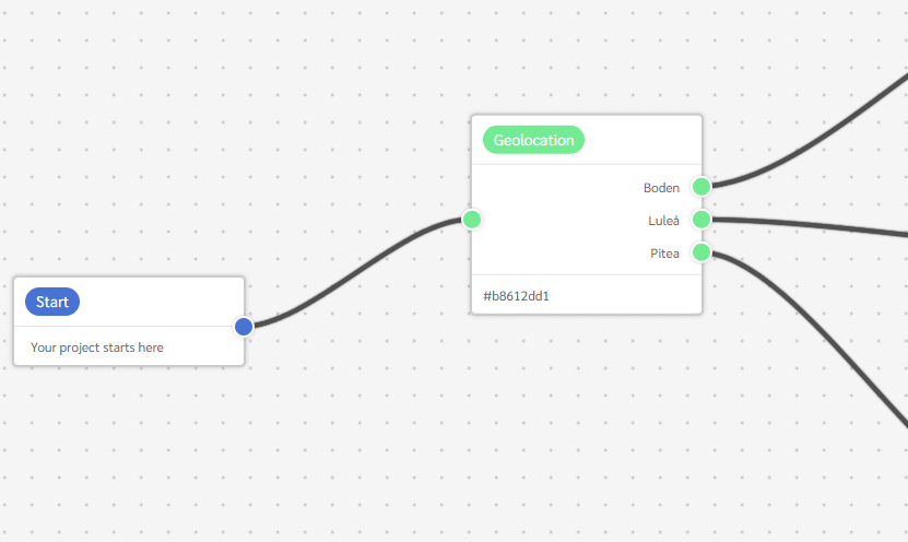
This is a view of how a Geolocation node looks like in the workspace
In the Geolocation node options, You will find an overview of all the absolute locations' entries:
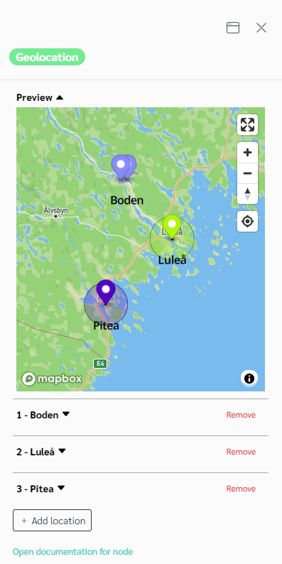
Each added location contains the following common information.
| Geolocation Node | |
|---|---|
| Label | The text to display on the output socket. |
| Mode | Detection mode for this location. |
Detection mode can be Absolute or Relative. - Relative mode is for a detection related to the actual player position. - Absolute mode is for a pre-know location or area.
- Relative mode options
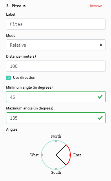
| Relative mode | |
|---|---|
| Distance | The minimum distance. |
| Use direction | Should the player move in a specific direction? |
| Min angle | If a direction is used. What is th minimum angle ? |
| Max angle | If a direction is used. What is th maximum angle ? |
- Absolute mode options
| Absolute mode | |
|---|---|
| Label | The text to display on the output socket. |
| Mode | The radius allowance in meters. |
| Form | The radius allowance in meters. |
In Absolute mode, choosing an area require selection the shape of th area to detect. It can be just a circle, or go with more details and choose a polygon.
2.1. Circle form options
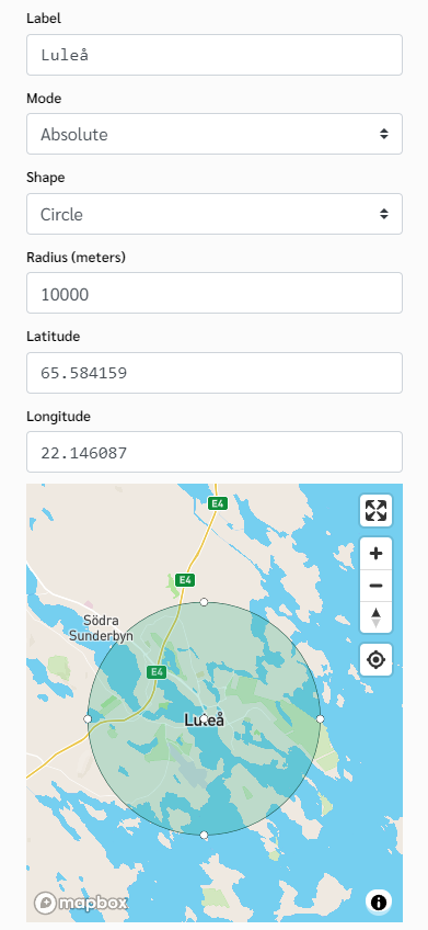
| Circle form | |
|---|---|
| Radius | The text to display on the output socket. |
| Latitude | The latitude value of your geopoint. |
| Longitude | The longitude value of your geopoint. |
You can use the map to place the center of the circle in the desired location which will update the latitude and longitude fields automatically.
2.2. Polygon form
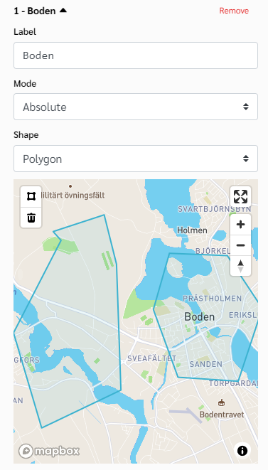
If you choose to the polygon form, you will have to use the drawing tool to draw a polygon inside the map.